Physiographic Chart Project:
Part A:
A physiographic chart is a map showing Earth's landforms, even under the sea! As we already learned, there are lots of land features underneath our oceans. Obtain a physiographic chart from your teacher, preferably printed on an 11x17 piece of printer paper. You can also print yourself (click here) if necessary. Only print the first page! You do NOT need the second page. You will make the following updates to your physiographic chart. Once finished, take a picture of your entire chart and upload in your performance task. Shrink down to a reasonable size.
Step 1: Across the bottom of your physiographic chart, make a legend/key for your map. Use the following color and symbol combinations below. You will need colored pens/pencils to do so.
Step 2: Obtain a "Earth's Surface Structure" map from the teacher. Share this map with a partner as there are not enough for each student. On your own physiographic chart (you may work with a partner, but each of you have to complete your own chart), make a continuous outline of the entire pacific plate with appropriate colors (red, blue, or black) to match the kind of boundary to. Where you are not sure of the type of boundary, make your lines dotted, but be sure to properly enclose the plate. Be sure to draw a transform fault line for the San Andreas Fault in properly in California. Label the plate and move on to the other plates below, checking them off as you go:
Part A:
A physiographic chart is a map showing Earth's landforms, even under the sea! As we already learned, there are lots of land features underneath our oceans. Obtain a physiographic chart from your teacher, preferably printed on an 11x17 piece of printer paper. You can also print yourself (click here) if necessary. Only print the first page! You do NOT need the second page. You will make the following updates to your physiographic chart. Once finished, take a picture of your entire chart and upload in your performance task. Shrink down to a reasonable size.
Step 1: Across the bottom of your physiographic chart, make a legend/key for your map. Use the following color and symbol combinations below. You will need colored pens/pencils to do so.
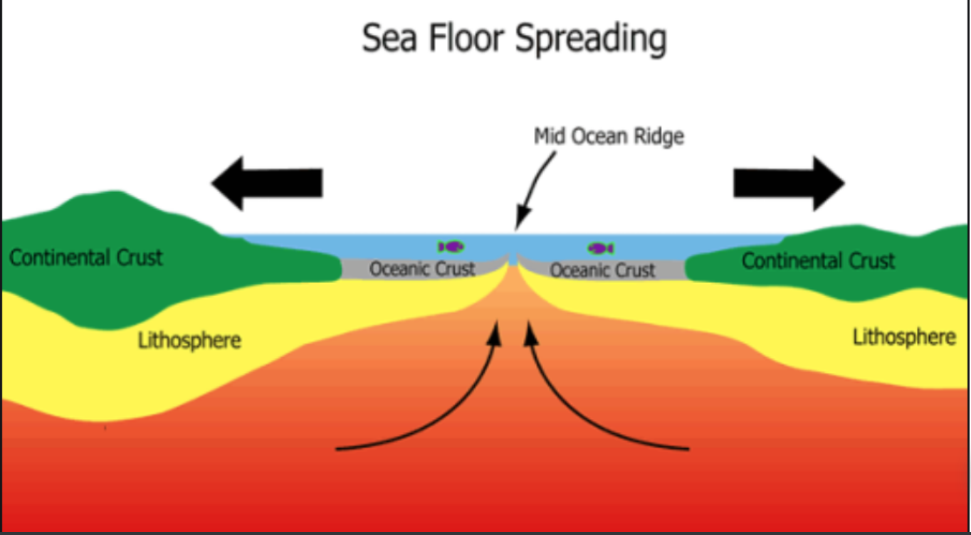
- Mid-Ocean Ridge (aka Sea Floor Spreading) - Red Line
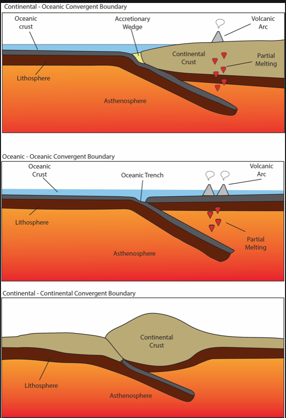
- Collision and Subduction - Blue Line
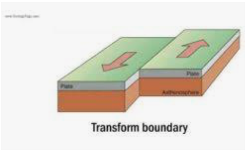
- Transform Faulting - Black Line
- Accretion - Green Triangles
- Hot Spots - Yellow Dots
Step 2: Obtain a "Earth's Surface Structure" map from the teacher. Share this map with a partner as there are not enough for each student. On your own physiographic chart (you may work with a partner, but each of you have to complete your own chart), make a continuous outline of the entire pacific plate with appropriate colors (red, blue, or black) to match the kind of boundary to. Where you are not sure of the type of boundary, make your lines dotted, but be sure to properly enclose the plate. Be sure to draw a transform fault line for the San Andreas Fault in properly in California. Label the plate and move on to the other plates below, checking them off as you go:
- African
- Antarctic
- Arabian
- Australian
- Caribbean
- Indian
- Juan de Fuca
- Nazca
- North American
- Phillipine
- Scotia
- Somali
- South American
Part B: Analyze the chart you created in Part A and answer the questions below in your performance task.
1. Name the narrow sea growing between two of the plates?
2. Name the two plates surrounding the narrow sea in the first question.
3. List the geological activities and features that accompany faulting.
4. List the geological activities and features that accompany spreading.
5. List the geological activities and features that accompany collision.
6. What geological features do you find next to all island arcs? Explain the reason.
