Major Ocean Currents Project:
Instructions:
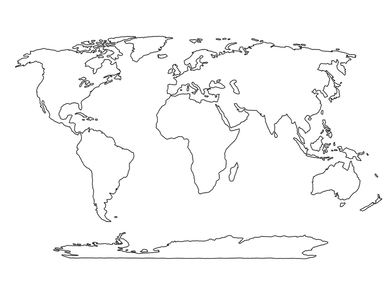
Step 1: Sketch the continents above on a piece of paper. No you can't print out the picture above and add to it. You must draw everything from scratch.
Step 1: Sketch the continents above on a piece of paper. No you can't print out the picture above and add to it. You must draw everything from scratch.
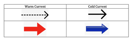
Draw all the major ocean currents listed below using arrows pointed in the direction that the current is flowing. Be sure to curve the arrows to show how the currents form gyres. Use a red or dotted arrow to draw warm currents and blue or solid arrows to draw cold currents. You will need to research where these currents are located and the direction that they flow. My suggestion is that you look up images of major surface currents on google. You will then need to analyze where the current is coming from to decide if it's warm or cold. If the current is flowing FROM the equator, it will be warm. If the current is flowing FROM the poles, it will be cold. Label each current on your map if you haven't already done so. You may use a key if you don't have enough room to write the current name. If this is the case, be sure to use a numbering system corresponding with the key. Put name full name (first and last) on top right corner of map. Take photo of work and upload image in correct space in performance task.
- California Current
- Canary Current
- Gulf Stream
- Kuroshio Current
- East Australian Current
- Benguela Current
- Brazil Current
- Peru Current
- Antarctic Cirumpolar Current
- Labrador Current
- North Equatorial Current
- North Equatorial Counter Current
- South Equatorial Current
- South Equatorial Counter Current
- Alaska Current
